AS 91189 Investigate geological processes in a New Zealand locality.
AS 91189 Investigate geological processes in a New Zealand.
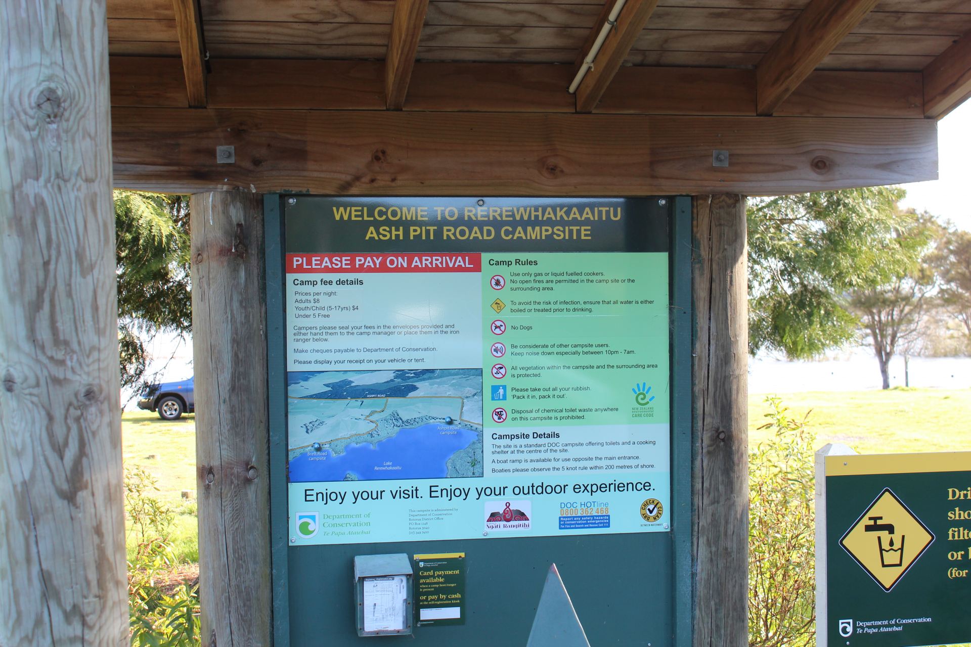
132,000 years of violent volcanic activity then they built Ash Pit Road (Prezi).
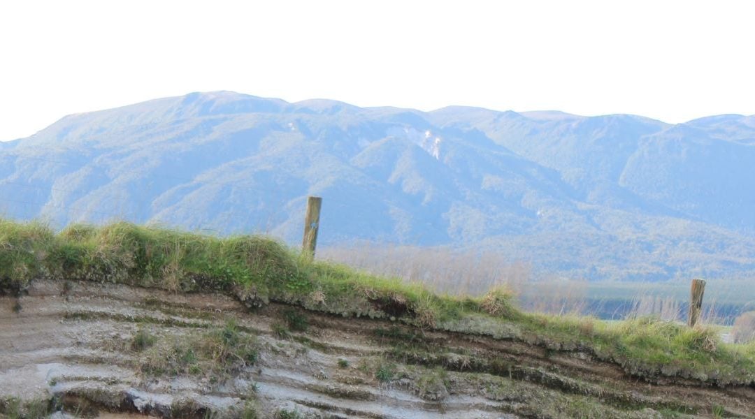
Tephra deposited from multiple eruptions in the Taupo volcanic Zone.The history of the area is written in layers of ash revealed in a cutting on Ash Pit road close to Rerewhakaaitu.
The land and Lakes Field trip document is a good resource and you should flick through it and highlight sections that deal with basalt, rhyollite, the Taupo and Tarawera eruptions. You will come across a section on the road cutting on Ash Pit road.
Skim read to begin with and don’t get bogged down in detail
 Loading...
The Tarawera eruption.
This is a useful resource on the Tarawera eruption
Loading...
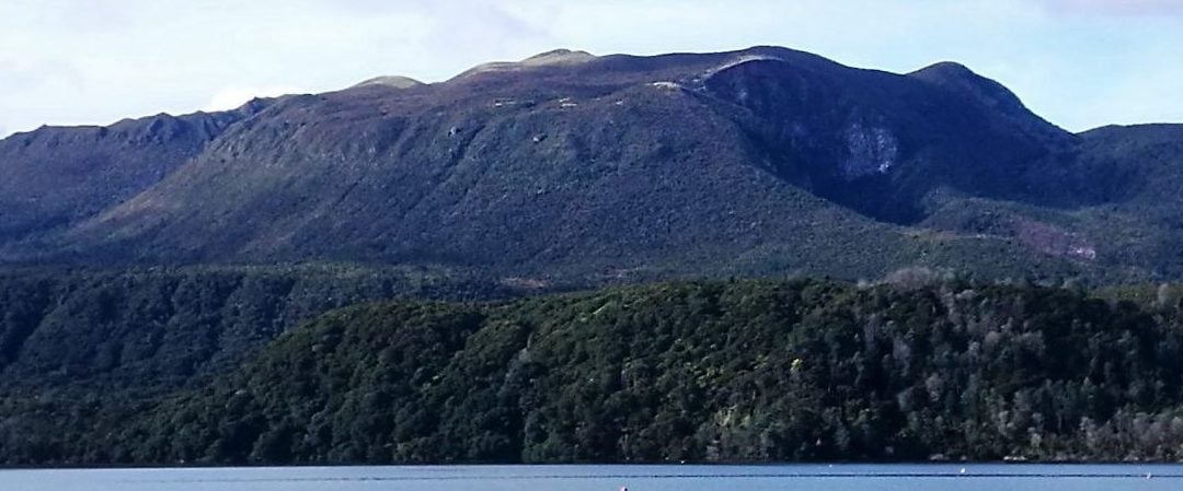
The Okataina Volcanic Complex
GNS Science, TE PU AO iis a government website with lots of Earth and Geoscience resources

The Okataina Volcanic Centre is part of The Taupo Volcanic Zone ( TVZ ).
Plinian eruptions send huge volumes of ash into the stratosphere and this can have global implications. Individual ash deposits show a fine grained layer at the top indicating that the eruption faded after the initial explosive event
New Zealand volcanoes such as Ngauruhoe and White Island, have relatively small eruptions every few months or years.
Eruptions in the Okataina volcanic complex, are 100 to 10,000 times larger than those at White Island or Ngauruhoe.
Okataina Complex volcanos have displayed eruption intervals between 700 and 3000 years.
 There have been 12 devastating Plinian eruptions in the period between 31 and ∼43 ka. The pyroclastic deposits total 77 km3. The biggest eruptions in the region were extremely destructive burying areas of up to 4,200 km2 to at least a depth of 1 meter.
The Auckland Region covers an area of 4894 km2 .
The Kaharoa eruption and The Great Famine of 1315-1317
The onset of the Great Famine coincided with the end of the Medieval Warm Period. Between 1310 and 1330, northern Europe saw some of the worst and most sustained periods of bad weather in the entire Middle Ages, characterized by severe winters and rainy and cold summers. The Great Famine may have been precipitated by a volcanic event,[3] perhaps that of Mount Tarawera, New Zealand, which lasted about five years. (Wikipedia)
[embeddoc url=”https://johnwest.edublogs.org/files/2017/10/kaharoa-eruption-2hgafjt-29wfwyy.pdf” d